
No commitments yet as feasibility study continues
Although it’s not yet known if Dutchess County will commit to a 13-mile rail trail connecting Beacon and Hopewell Junction, a planning firm it hired told the City Council on Monday (March 3) that it has found no major roadblocks.
“This is all buildable,” Tom Baird, an engineer from Barton & Loguidice, the Albany firm conducting a feasibility study with the county, told the council. “There aren’t big obstacles, there aren’t major environmental concerns. We don’t have any real hazardous materials to worry about, either.”
Dutchess County released a report on conditions along the Beacon Line, an abandoned rail spur, in November. A final report, with detailed concepts, cost estimates and phasing recommendations, should be finished by the summer. The Monday presentation to the City Council can be viewed at highlandscurrent.org/rail-trail-deck.
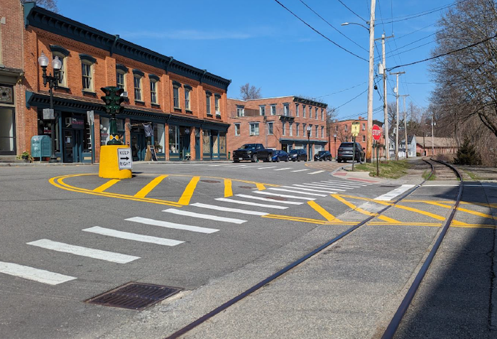
The proposed trail would begin at the Beacon Metro-North station, a stone’s throw from the Hudson River, then wind for 4 miles around the city’s southern perimeter before running parallel with Tioronda Avenue and the east end of Main Street. Major crossings would include Churchill Street and East Main Street (at the dummy light). The trail would run underneath Route 9D (at Tioronda Avenue) and hug northbound Route 52 (Fishkill Avenue) to the city line.
The trail would connect with the proposed Hudson Highlands Fjord Trail near the bridge at Madam Brett Park, where the planners said a trailhead could be located. Scenic Hudson, which is building the Fjord Trail between Beacon and Cold Spring, is a member of the Beacon-to-Hopewell Trail Advisory Committee.
Once the rail trail leaves the city, it would veer back and forth over Fishkill Creek on its way through the Village of Fishkill and the towns of Fishkill and East Fishkill. At Hopewell, it would connect with the Dutchess Rail Trail, the Maybrook Trailway and, overlaying both, the 750-mile Empire State Trail.
The abandoned rail line is owned by the Metropolitan Transportation Authority. A year ago, Metro-North, an agency of the MTA, “railbanked” the line, reserving the right to revive service, although an agency representative told The Current in February 2024 that it had no plans to do so.
The important takeaway from the conditions study is that “the majority of the corridor is in really good condition,” said Chris Hannett, another Barton & Loguidice engineer, on Monday.
There are two options for constructing a trail, although one would be a much heavier lift. A “rail-with-trail” conversion, in which the tracks remain in place, would present many challenges, including a 20- to 25-foot buffer required between the tracks and any trail. Bridges in the corridor, which are no longer safe for trains, would have to be rebuilt, adding significant cost and environmental impacts, and right-of-way acquisitions would be required.
The second option, a “rail to trail,” would permit the reuse of bridges and ballast stones, the rocks used to stabilize the tracks, but the rails would be removed. A rail to trail would minimize environmental impacts, with little and possibly no rights-of-way needed.
When the study began, Metro-North’s abandonment of the line had not been approved by the federal Surface Transportation Board, so the engineers studied both options. The final report will include both but won’t recommend either, instead letting “the engineering and the cost speak for itself, as well as the environmental impacts,” Baird said.
The planners anticipate a 12-foot-wide path made with a crushed-stone mix or asphalt, depending on the location. It would likely be compliant with the Americans with Disabilities Act and could be lighted because of its proximity to dense urban areas.
Baird said the county is conducting the study because funders often consider projects “and some will scratch their heads [and say], ‘Can they really do that?’ ” With a report analyzing environmental impacts and other factors, “it’s a lot easier to get funding and move these projects forward,” he said.
The study team last year received more than 1,350 responses to an online survey, with 95 percent supporting construction of a trail in the corridor. Respondents asked for the pathway to include bathrooms, benches, waste receptacles and directional signs.
A virtual public meeting will be held at noon on March 20; participants can register at beaconhopewellrailtrail.com. A second public meeting will be held in the spring, before the release of the final report.

The proposed trail would take you from the Beacon Falls right into the backyard of my store on Main Street in Fishkill, Supreme Pianos of NY, then across Route 9. After that, it’s accessible at Doug Phillips Park, down into Lomala in Hopewell Junction. I have been wanting to walk it for a while but parts of it forbid trespassing. A rail trail there would be cool. You can also go canoeing near it. [via Instagram]
It will be interesting to see what type of Route 9 crossing is used — either the Elm Street light in Fishkill near Wendy’s or a pedestrian overpass with graded ramps such as was done over Route 376 near the border of Wappingers Falls and Hopewell Junction and over Route 55 at Overlook Road in Poughkeepsie.
People scurry across Route 9 trying to beat the lights all the time in Fishkill near the Walmart. It seems sketchy with the erratic crossers, let alone a steady stream of trail users. There’s no way Route 9 traffic will halt like it had to when trains still crossed Route 9 in the 1980s and early 1990s. [via Instagram]